From where I’m looking there seems to be a love-hate relationship with salt. Sure it is bad for me, groundwater – your drinking water. But when it’s time to deal with snow and ice, there isn’t anything else that works quite like salt.
Have you ever thought about how much of your community is paved? There are the roads, community trails, sidewalks, driveways and parking lots. During the winter, all these areas need to be kept clear of snow and ice for both accessibility and safety.
Figure 1 – Many communities include a lot of paved areas that require salting in the winter. Aerial view of Waterloo Region.
When it comes to the environmental impacts of salt, the tendency is to point the finger at other people and groups. They are the reason so much salt is spread.
What if I told you everyone, to some degree, contributes to the problem but can also be part of the solution. How can that be? You might be thinking “I don’t use much, if any salt” or “I only use such a small amount compared to others”.
That might be so but let’s think about why salt is used. Sure it makes removing snow and ice that much easier by lowering the freezing point when water in its liquid form changes to ice. That’s more of a technical answer but the reasons go much deeper making it a complex problem to solve.
Here are a few of those reasons why so much salt is spread.
Liability. The fear of being sued is one of the biggest reasons businesses spread so much salt. Too much is used and it’s spread even when it’s not needed or when it’s too cold for the salt to be effective.
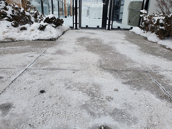
Salt means safety. When you go for a walk or drive and see salt, it can make you feel safe. You know the property owner is doing their part to clear the snow and ice. But what if you don’t see salt on the ground. Does that mean it isn’t safe? Should you demand the property spread more salt? Maybe there isn’t any ice and salt isn’t necessary. Maybe salt isn’t the right tool for the current weather conditions. Or maybe the right amount of salt has already been put down and has turned into a liquid brine that – even though you can’t see it – is still hard at work. Whatever the reason, salt is not always the right or only tool for dealing with snow and ice. And not seeing salt on the ground doesn’t necessarily mean it is less safe.
Figure 2 – Does more salt make you feel safer?
3. Expectations. It’s winter. You are going to have to deal with snow and ice at some point. Yet there is an expectation to be able to travel the same as if it was summer. For this to be a reality can mean more salt spread to speed up the melting process. Is there a way to balance expectations for clear passage while still protecting me – your drinking water – from the damaging impacts of salt?
4. Changing weather. In Southern Ontario, winter can mean snow, freezing rain, rain, warm temperatures, or really cold temperatures. You get where I’m going with this. As weather patterns change, meeting expectations to keep areas clear of snow and ice can be a challenge and might include the spreading of more salt to meet expectations of clear pavement all of the time.
5. Personal safety.Wearing winter boots and switching to winter tires can seem like an inconvenience and an unnecessary expense. But living where there’s snow and ice should include taking these preventative steps to protect yourself. This also means giving yourself extra time to get to your destination and driving, biking or walking for the current weather conditions.
Video: Walk Like a Penguin (Alberta Health Services)
Not everyone uses salt but everyone at some point uses the surfaces that are salted. Changing actions and expectations over time might help support the responsible use of salt required to better protect the environment including me, groundwater – your drinking water, because – well – I think I’m worth protecting.
If you’re a history buff, or even if you’re not and would like to learn more about Waterloo Region’s past, then this post is for you! Our story begins in the town of Berlin, Ontario. Haven’t heard of Berlin? If you live in Waterloo Region, you most likely have been there. You see, Berlin today is Kitchener.
Berlin’s beginnings start in the early 1800s and quickly becomes a thriving community. Between 1881 and 1891, Berlin’s population grew by 83 per cent. The blog Rye & Ginger: Berlin, Ontario until 1916, tells how “By the 1850s, the growing town became the County Seat. Its political and economic influence grew, helped by the arrival of the Grand Trunk Railway.”
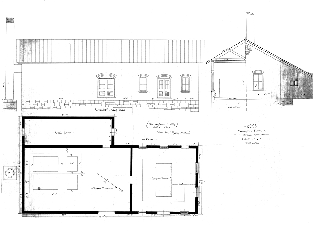
Let’s fast forward to 1888. A water system that includes fire protection becomes a growing interest for the community. To address this need, the Berlin Waterworks Company – privately owned by Moffet, Hodgins and Clarke – constructs the first water supply plant to serve this thriving and growing town. The plant is built near the water source – Shoemaker Pond.
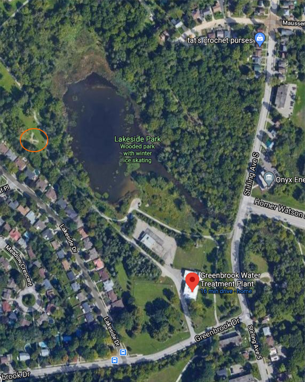
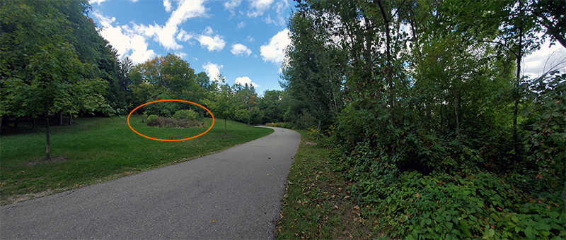
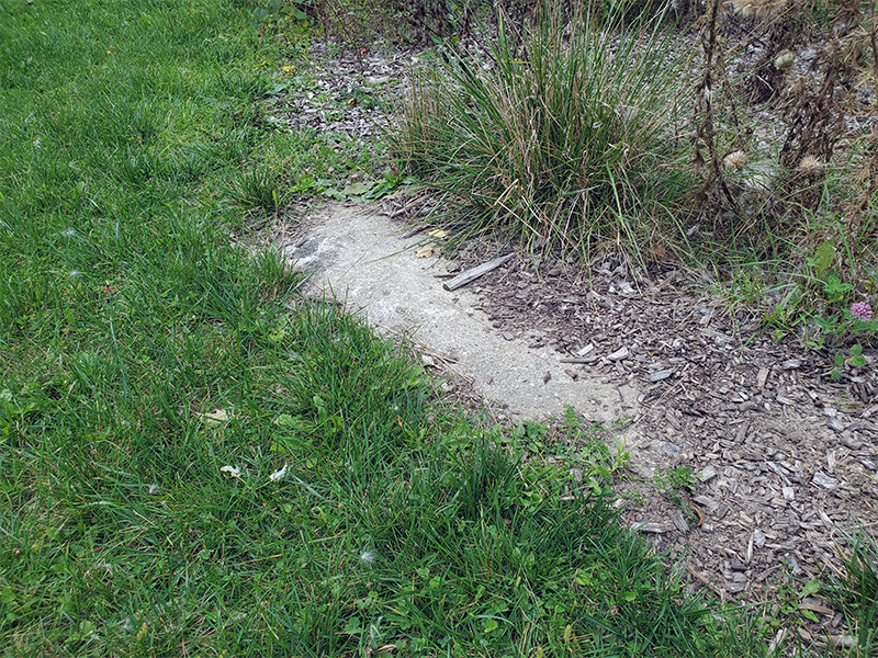
The site is located at what is now known as Lakeside Park near where the Greenbrook Water Treatment Plant now operates at 20 Greenbrook Drive in Kitchener. Today, the area looks much different surrounded by residential homes. In 1888, the location is in the country with no homes in site. Today, if you look closely, remnants of the water supply plant foundation can still be found off the path that connects the Greenbrook Water Treatment Plant parking lot with Queen’s Blvd.
Location of the first water supply plant (figures 1 to 3)
Figure 1: Starting at the Greenbrook Water Treatment Plant, follow the path keeping Shoemaker Pond on your right until you reach the location circled on the map. Credit: Google Maps
Figure 2: Walking up the path with Shoemaker Pond on your right you will come across a flower bed on the left side of the path.
Figure 3: Upon closer inspection of the flower bed closest to the path you might see part of the foundation for the water supply plant built in 1888.
From 1888 to 1899, the water supply plant provides water from Shoemaker Pond to the residents of Berlin. I’m sure you can imagine what the water quality from the pond might look, smell and taste like – especially during the summer months. Public dissatisfaction with the supply persuades the citizens of Berlin to vote for a municipal water works, a very innovative idea for that time. In 1898, the Berlin Water Commission purchases the plant and takes over the responsibility of supplying water to the town.
Figure 4 – 1888: drawing of water supply plant in Berlin.
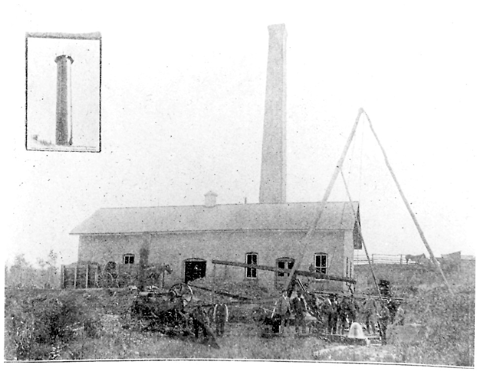
Figure 5 – 1888: persons at a groundwater well in front of the water supply plant in Berlin.
Figure 6 – Map of Shoemaker Pond with locations of groundwater wells and water supply plant.
“If the present popularity of meters continues it will not be long till all services are metered and it is my opinion that the sooner this time arrives the better for all concerned. It is not probable that the water supply of Berlin will ever be so abundant that reckless wastes can be permitted and I know of no means of checking this more effectually than by the general use of water meters.”
Wm. Mahlon Davis, Superintendent, 1st Annual Report of the Water Commissioners of the town of Berlin, 1899.
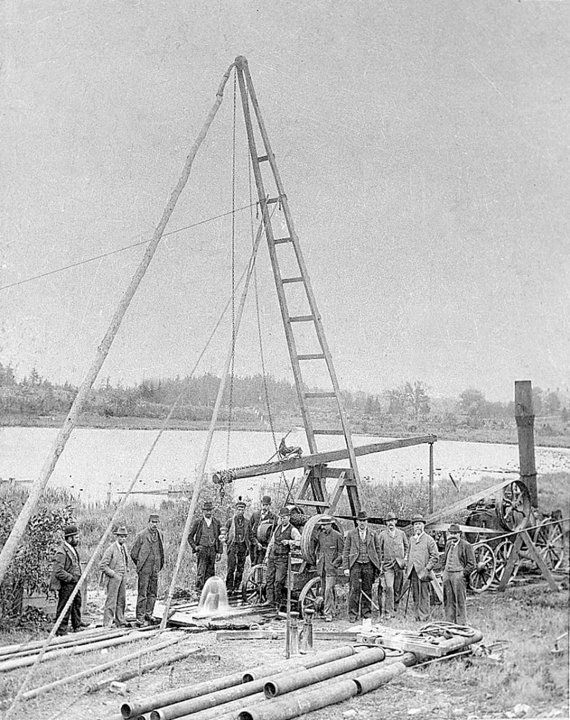
On May 19, 1899, the Berlin Water Commission begins work to move away from supplying Berlin with water from Shoemaker Pond by drilling wells to extract groundwater (that’s me!). Throughout the year, 10 wells are constructed with the capacity to provide the community with about 4.5 million litres of water each day.
Figure 7 – 1899: persons drilling a groundwater well near Shoemaker Pond in Berlin.
“It is a water of remarkable purity, and in hardness even as low. I congratulate the town in the supply it has secured.”
John J. Mackenzie, Bacteriologist Office of Provincial Board of Health, 1899, regarding the new wells drilled for the town of Berlin.
In 1911, the first prohibition on lawn watering is enforced in Berlin supported by the hard working, frugal nature of Berlin residents who value the importance of conserving water.
“Any scheme that prevents reckless waste of water and at the same time reduces the volume of sewage as this should be encouraged.”
Wm. Mahlon Davis, Superintendent, 3rd Annual Report of the Water Commissioners of the town of Berlin, 1901.
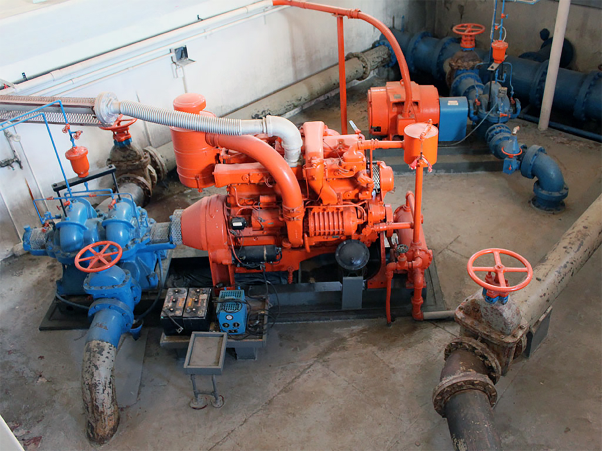
In 1912 a pump house – to help move groundwater once extracted from the wells through the distribution system – is built where the Greenbrook Treatment Plant now stands. Over the years, this building has expanded to included improved treatment processes.
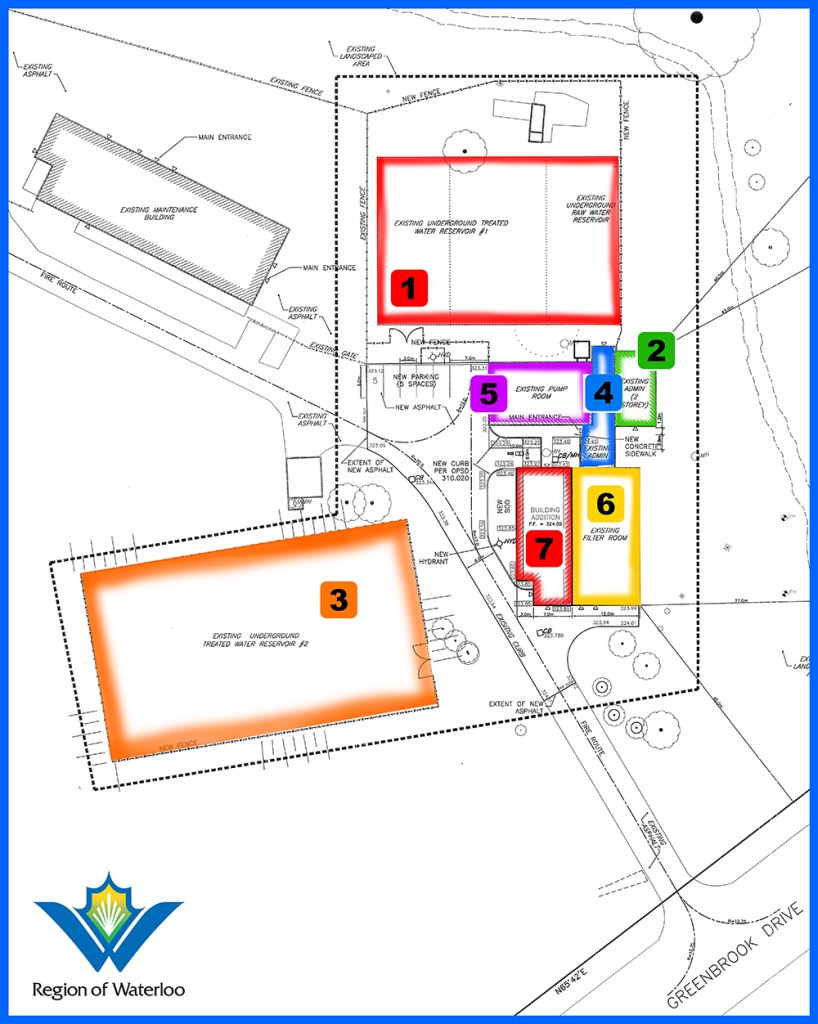
Figure 9 – Construction timeline for Greenbrook Water Treatment Plant and reservoirs. See below for legend.
Number on map
Year built
Description
1
1914
underground raw water reservoir
2
1930
diesel house; now administrative area
3
1937
underground drinking water reservoir
4
1959
administrative area
5
1959
pump room (replaces 1912 pump house and 1916 filter building)
6
1990
iron and manganese filter room
7
2010
advanced oxidation process treatment room
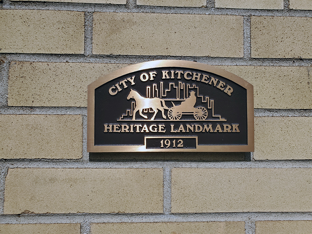
Figure 8 – In 1998, the Greenbrook Water Treatment Plant was designated as a heritage building for its importance in the early years of public service, and its Romanesque revival architecture in the 1930, 1959 and 1990 additions.
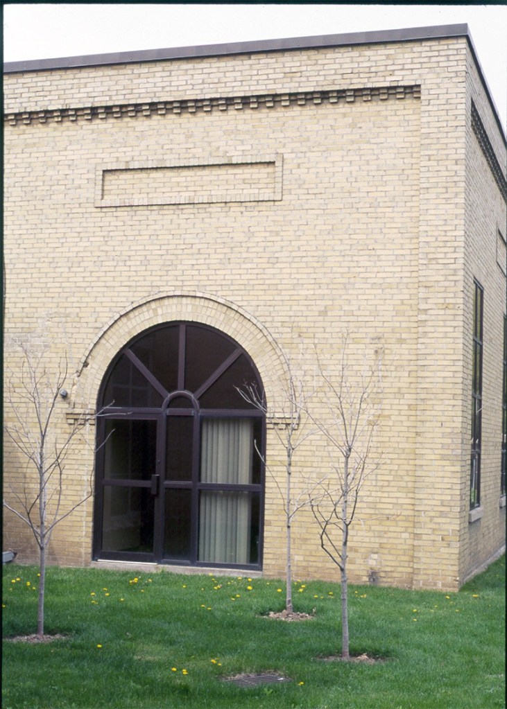
Figure 10 – Section of Greenbrook Water Treatment Plant built in 1930.
Berlin is now Kitchener with a population of more than 230,000. The 10 wells drilled in 1899 are no longer operational. There are five supply wells we use today. The wells were drilled in 1986 to 2015 and range in depth from 32 to 50 metres extracting groundwater from a sand and gravel aquifer.
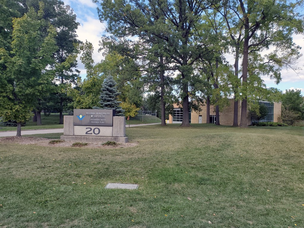
Figure 11 – Greenbrook Water Treatment Plant.
Today, five supply wells, many monitoring wells, two reservoirs and a treatment plant make up the Greenbrook wellfield. The wellfield provides 8 per cent of the drinking water for Kitchener – about 6.5 million litres – enough to fill 130 backyard swimming pools every day.
Historical timeline:
1854 – Berlin incorporated.
1888 – American firm forms the Berlin Waterworks Company and begins pumping at Shoemaker Pond.
1889 – Town of Waterloo signs 10-year contract with Berlin Waterworks Company to supply water.
1896 – A major factory fire in Berlin causes a change in community acceptance of public water supply systems.
1898 – Town of Berlin buys Berlin Waterworks Company for $102,000.
1899 – Berlin Commission forms and constructs the first well near Shoemaker Pond.
1911 – First ban on lawn watering in Berlin and Preston due to water shortages.
1914 to 1919 – World War I slows expansion of municipal waterworks due to lack of labour and materials.
1916 – Berlin changes its name to Kitchener.
1927 – 3.8 million litre capacity water tower built on George Street in Kitchener (2011: decommissioned).
1930 – Municipal water supplies are solely from groundwater wells.
1931 to 1934 – Government work programs during the Depression aid growth of water pipe network.
1939 to 1945 – World War II causes rising industrial water use, straining municipal supplies.
1953 – Mannheim wells begin supplying Kitchener with 20 per cent of water supply. This lessens demand for water from the Greenbrook wells.
1955 – Ontario Water Resources Commission established. Kitchener is one of 14 municipalities represented.
1965 – Waterloo County Planning Area established.
1973 – Regional Municipality of Waterloo forms and assumes responsibility for municipal drinking water supply.
1974 – First watermain swabbing used to clean watermain pipes.
1992 – The Mannheim Water Treatment Plant begins purifying surface water from Grand River for municipal water supply.
1993 – 6.8 million litre capacity water tower at a height of 50.77 metres is built on Sportsworld Drive in Kitchener.
1998 – City of Kitchener designates the Greenbrook Treatment Plant as a heritage building for its importance in the early years of public service, and its Romanesque revival architecture in the 1930, 1959 and 1990 additions.
In 1888 Berlin Waterworks Company built a water pumping station in Berlin (now Kitchener) to supply water from Shoemaker pond. Today 5 groundwater wells at the Greenbrook Water Treatment Plant supply Kitchener with water. #WRhistory #Iamgroundwaterblog
It’s the late 1800s. The Town of Waterloo – with a population of less than 3000 – is in need of a water system and must make the decision of how to supply water to the community. Waterloo voters reject a proposal of municipal ownership of the water works – a new idea at the time.
In 1889 the town signs a 10-year contract with Waterloo Water Works – a private company – to supply water to the community. The Waterloo Water Works company hires the Berlin Waterworks company to supply Waterloo with water.
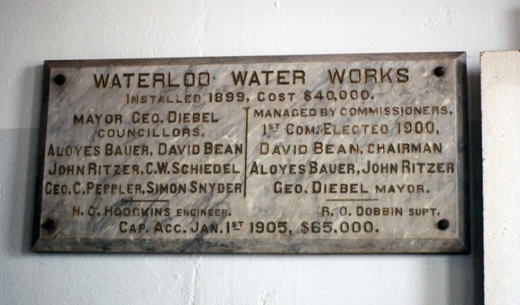
In April 1899, the poor quality of the water supply influences the passing of a bylaw for a municipal water works. This prompts the construction of the William Street Pumping Station and three drinking water wells funded through a debenture of $40,000. A small, open reservoir connected to the three underground reservoirs handles any overflow. The open reservoir also served as a decorative feature and often included fish.
Figure 1 – Plaque commemorating the formation of the Water Commission and construction of the William Street Pumping Station in 1899.
The wells that operate today were constructed in the 1940s and 1950s. They are about 35 metres deep and extract groundwater from a sand and gravel aquifer which is at the edge of the Waterloo Moraine. One reservoir with a 2.3 million litre capacity is located on the north end of the property.
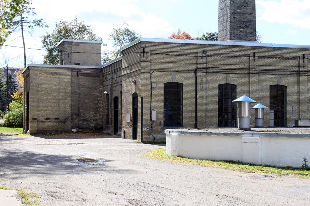
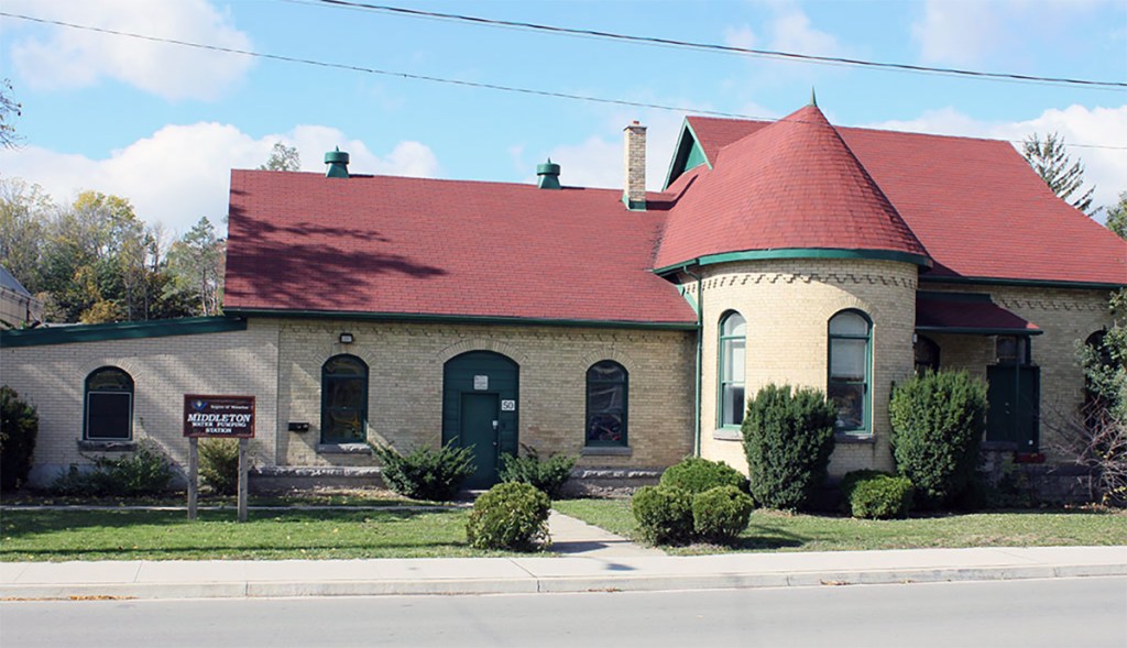
Figure 2 – William Street Pumping Station near King Street and across from Waterloo City Hall.
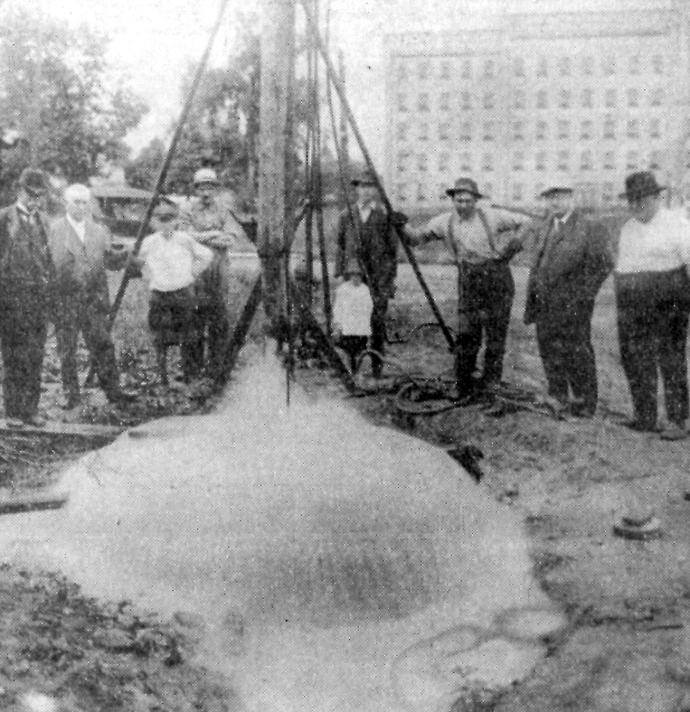
Figure 3 – Waterloo Public Utilities Commission and town officials tapping an artesian well on Caroline Street, 1919.
The William Street property is shared with Waterloo North Hydro. In 1910, the town’s Water Commission became the Water and Light Commission and in 1928, became the Public Utilities Commission. Unlike the water utility, the power utility was later privatized as Waterloo North Hydro.
During the early days of the Water Commission, the chief operator lived in one of the homes behind the William Street Pumping Station. The operator had to live nearby in order to be available to fix problems and to keep the pumping station operational.
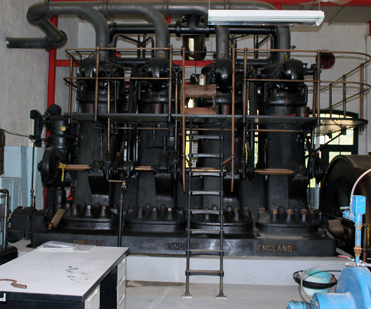
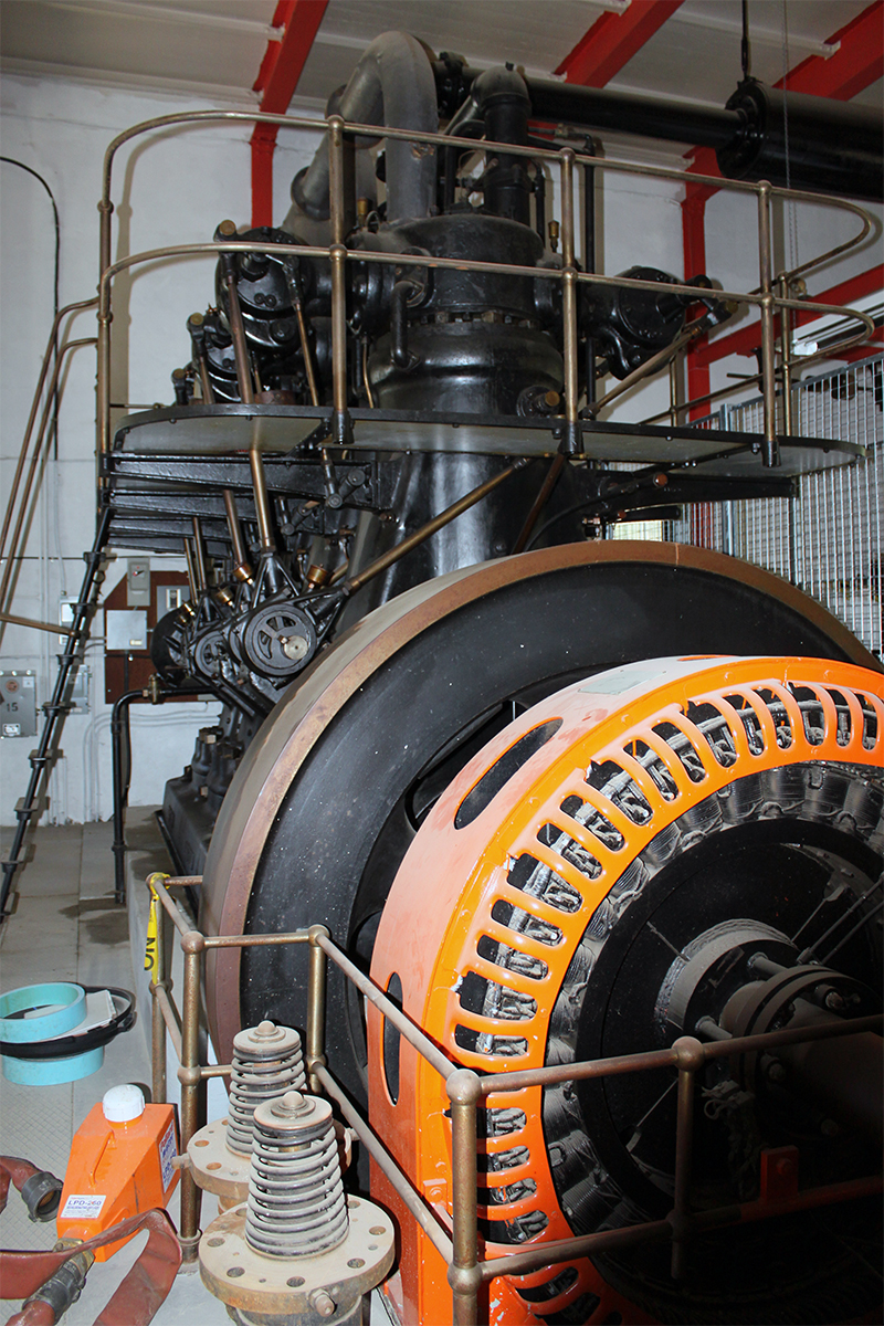
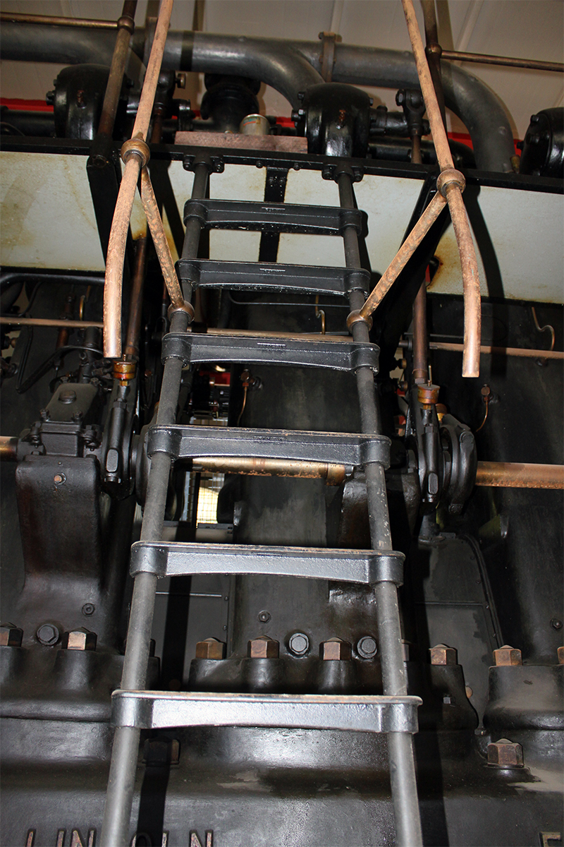
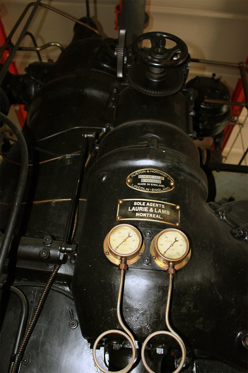
A diesel generator fuelled with coal was used to power the pumping station and also was a backup source of power for the nearby Waterloo Threshing plant. After electricity was connected, the diesel generator was used as an emergency backup power source. The last time the generator was used was July 1989. The generator and a wall board with the custom tools once used to maintain the generator and other machines still exists.
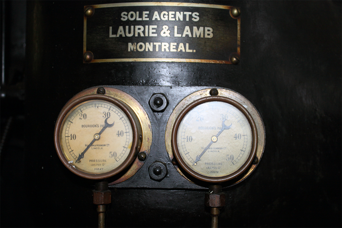
Figure 4 – Diesel generator once used to run the William Street Pumping Station.
Figure 5 – A wall board with the tools once used to maintain the diesel generator.
The coal required to run the generator was delivered through a chute door located next to the main door of the pumping station.
Figure 6 – Chute door once used to deliver coal for the diesel generator.
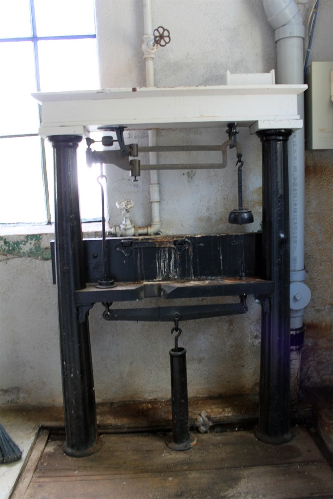
Figure 7 – Scales once used to weigh coal for the diesel generator.
Historical timeline:
1876 – Waterloo incorporated.
1889 – Town of Waterloo signs 10-year contract with Berlin Waterworks to supply water.
1899 – Waterloo buys part of waterworks system from Berlin Waterworks Company and builds the William Street pumping station and 3 wells at a cost of $40,000.
1914 to 1919 – World War I slows expansion of municipal waterworks due to lack of labour and materials.
1928 – Waterloo replaces Water & Light Commission with Waterloo Public Utilities Commission.
1930 – Municipal water supplies are solely from groundwater wells.
1931 to 1934 – Government work programs during the Depression aid growth of water pipe network.
1939 to 1945 – World War II causes rising industrial water use, straining municipal supplies.
1950 to 1956 – Waterloo is the fastest growing city in Canada with a population increase of 35.7%.
1965 – Waterloo County Planning Area established.
1966 – Fluoridation is introduced to water in Waterloo to promote dental health (discontinued in 2010 following referendum vote).
1973 – Regional Municipality of Waterloo forms and assumes responsibility for municipal drinking water supply.
1974 – First watermain swabbing used to clean watermain pipes.
1987 – 27 million litre capacity water tower at a height of 25 metres is built on Conservation Drive in Waterloo.
1989 – City of Waterloo designates William Street Pumping Station as a heritage building for its historic and architectural value.
1992 – The Mannheim Water Treatment Plan begins purifying surface water from the Grand River for the municipal water supply.
2013 – 7.2 million litre capacity water tower at a height of 41 metres is built near Ira Needles Boulevard in Waterloo.
In 1899 the Town of Waterloo Water Commission built the William Street Pumping Station and three wells. Prior to that, Berlin (now Kitchener) supplied water to Waterloo from a pond. #WRhistory #iamgroundwaterblog
Galt (now part of Cambridge) was the first community in Waterloo Region to have a publicity owned waterworks. Galt – like many communities – wanted a waterworks for fire protection, but also to compete with nearby Berlin (now Kitchener) for industry and residents.
The year is 1888 and after much debate in the community, Galt votes down – 2 to 1 – having a public waterworks. However, in 1890 a bylaw is passed and a construction contract signed to build a water pumping station on Middleton Street.
Even though Middleton Water Pumping Station is built along the Grand River, the river is not an option for a water source. The river has very low flow sometimes because control dams have not yet been constructed to control water levels. Water quality for the Grand River is also poor due to contamination from industrial discharges including dyes from nearby garment factories.
So instead of accessing water from the Grand River, water is redirected from nearby springs. In 1895, the source switches to groundwater when the first well is drilled and constructed. The following year in 1896 a second well is built. Today, there are still operating wells in the same location, and it is very likely that they are the same wells; open holes drilled into the deeper fractured rock and sealed through the shallow rock to protect the deeper water quality.
In 1902, the long low section of the Middleton Water Pumping Station is the reservoir. This reservoir has since been removed but the north wall of the pumping station still shows the marks of the building.
Figure 2 – Low section of the Middleton Water Pumping Station where reservoir was located.
Figure 3 – Wood reservoir at the Middleton Water Pumping Station.
In 1973, when Galt, Hespeler and Preston amalgamate to form Cambridge, the water works, including the Middleton Water Pumping Station, become the responsibility of the Regional Municipality of Waterloo.
In 1996, a new facility is built on the same five-acre lot to expand the capacity of the system to handle 20 million litres of water a day – six times the capacity of the original water works.
Today, all the water pumped at the Middleton Water Pumping Station is from five groundwater wells.
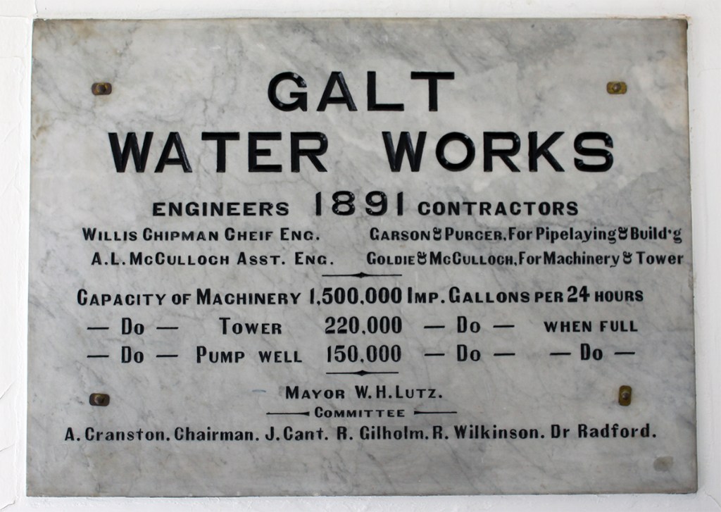
Figure 4 – Middleton Water Pumping Station dedication plaque. Look closely – can you spot the spelling mistake?
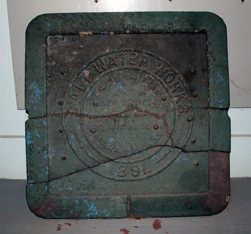
Figure 5 – Galt Water Works sewer cover, 1891.
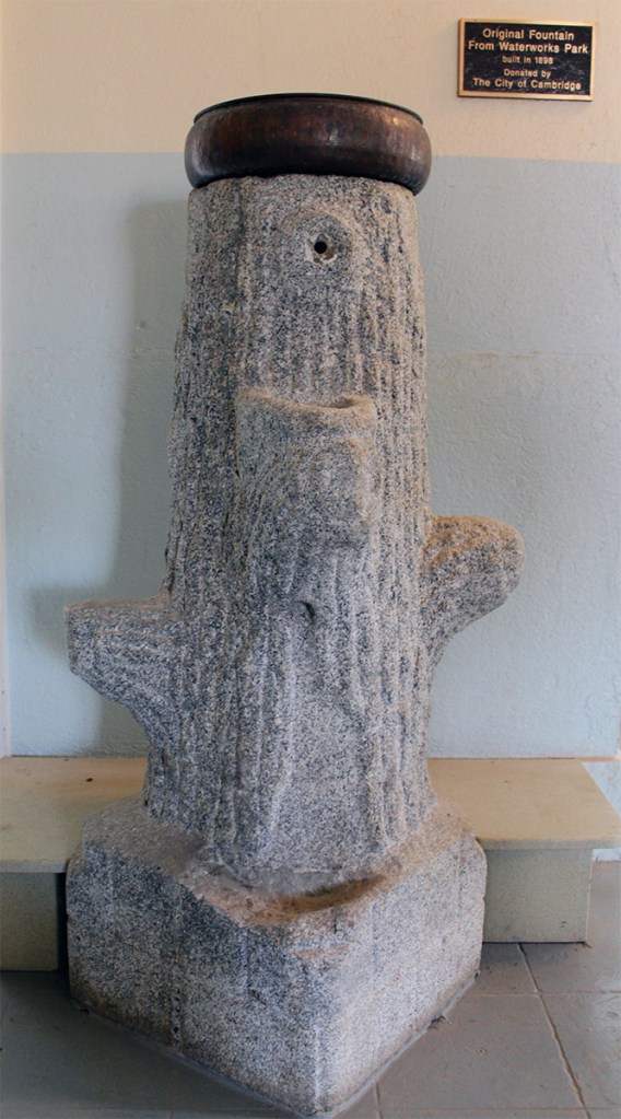
Figure 6 – Original fountain from Waterworks Park built in 1898.
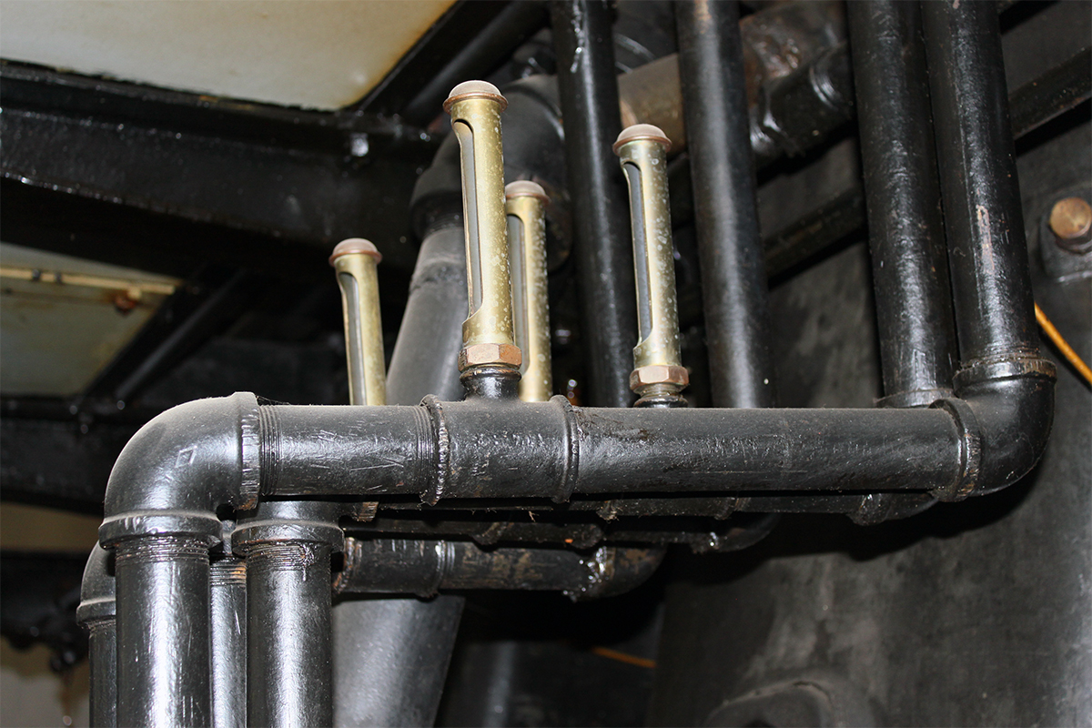
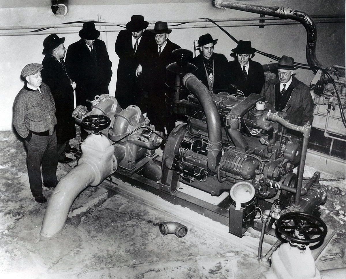
Figure 7 – Motor and pump inside the Middleton Water Pumping Station. Move the slider between the photos to compare the photo on left taken in the 1950s and the photo on the right from 2012.
Figure 8 – Pump inside the Middleton Water Pumping Station, 1950s.
Historical timeline:
1850 – Galt incorporated.
1852 – Preston incorporated.
1859 – Hespeler incorporated.
1890 – Galt forms public water utility.
1890 – Middleton Water Pumping Station is built.
1891 – 977,000 litre capacity water tower at the height of 15 metres is built on St. Andrews Street in Galt. (2017: decommissioned)
1901 – all Galt services are metered to monitor water consumption.
1907 – Preston and Elmira start municipal waterworks.
1911 – First ban on lawn watering in Berlin and Preston due to water shortages.
1914 to 1919 – World War I slows expansion of municipal waterworks due to lack of labour and materials.
1915 – Hespeler passes bylaw for municipal waterworks.
1919 – Galt Public Utilities Commission promotes water conservation campaign.
1920 – Preston water services all billed meters.
1930 – Municipal water supplies area solely from groundwater wells.
1931 – Preston experiences water shortages; disconnects drinking water fountains and turns off water to horse troughs and obtains water from Galt.
1931 to 1934 – Government work programs during the Depression aid growth of water pipe network.
1939 to 1945 – World War II causes rising industrial water use, straining municipal supplies.
1949 – 3.4 million litre capacity water tower at a height of 18 metres is built on St. Andrews Street in Galt.
1950 – Preston Public Utilities Commission is formed.
1965 – Waterloo County Planning Area established.
1972 – 3.4 million litre capacity water tower at a height of 27 metres is built on Edward Street by Harvey Lane in Hespeler (1982: decommissioned).
1973 – Galt, Hespeler and Preston amalgamate to form Cambridge.
1973 – Region Municipality of Waterloo forms and assumes responsibility for the municipal drinking water supply.
1974 – First watermain swabbing is used to clean watermain pipes.
1974 – 2.2 million litre capacity water tower at a height of 34 metres is built on Preston Parkway in Cambridge (2009: decommissioned).
1978 – 2.2 million litre capacity water tower at a height of 32 metres is built on Dalkeith Drive in Cambridge.
1982 – 17 million litre capacity water tower at a height of 34 metres is built on Pinebush Road in Cambridge.
1992 – The Mannheim Water Treatment Plant begins purifying surface water from the Grand River for the municipal water supply.
1997 – City of Cambridge designates the Middleton Water Pumping Station as a heritage building for its architectural and historic value.
In 1890 the Galt Water Works began construction on the first water pumping station in Galt (now part of Cambridge) to supply water from a spring. Still in operation, the Middleton Pumping Station houses five wells. #WRhistory #iamgroundwaterblog
Maps are great tools. They can help you find where you are, provide information on nearby landmarks and help guide you to your final destination. Remember the good ole days of paper maps? Now-a-days I’m guessing many of you use a GPS or an APP on your phone to help you get around.
For me – groundwater, I don’t really need a map. Partly because it would be really hard to read down here in the aquifer but mostly because I honestly don’t care where I am or where I end up. For me, there are no borders or boundaries thanks in part to the water cycle.
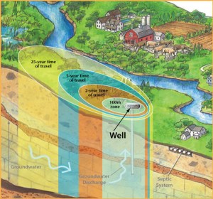
However, my friends at the Region of Waterloo seem to think otherwise. They like to track my every movement – where I soak into the ground, how long I’m underground and the different paths I take to reach the 120+ municipal supply wells in Waterloo Region.
Each municipal supply well is in a Wellhead Protection Area made up of four zones: 100-metres, 2 years, 5 years and 25 years. The 100-metre zone is the closest to the supply well, with the remaining zones marking the time it takes for me to reach the well.
Wellhead Protection Areas surround each municipal supply well in Waterloo Region Image credit: Conservation Ontario
Understanding the geology of the land
With the help of computer modeling, hydrogeologists can track my movement and use this information to create Wellhead Protection Area maps.
To understand how I move underground you first need to know what materials I’m moving through. Aquifers, where you can find me, are made of different layers of materials such as sand, gravel, clay and bedrock. No two aquifers are the same. The layers in one aquifer can be very different from another. And in fact, the types of materials and how they are layered can change in a single aquifer.
As I slowly move through the spaces between these materials I travel at different rates of speed. Sand is like a sponge, slowing me down as well as acting as a natural filter. Rocks and gravel with larger spaces or cracks provide me with more room so I can travel at a quicker pace compared to sand. Clay is like a big ole stop sign for me. Its hard-packed and dense material acts as a barrier forcing me to change my route.
Wellhead Protection Area map for Waterloo Region. Area in red is closest to the supply well.
Why Wellhead Protection Area maps are important
One reason Wellhead Protection Areas are important is they help bring attention to me. When you look around it’s easy to see the lakes and streams. But I hide underground so I don’t always get the attention I deserve. You know the saying – out of sight – out of mind.
The maps help make groundwater real and hopefully more valued. They provide important information on my whereabouts and the journey I take to each municipal supply well.
And finally, the Wellhead Protection Area maps are an important groundwater protection tool supporting actions using the Source Water Protection Plan to reduce risks from pollution to groundwater.
And as the official drinking water for Waterloo Region, I’d like to think I’m worth protecting.
Cheers, Groundwater
Wellhead Protection Area maps show how groundwater moves to each of the @RegionWaterloo 120 supply wells. An important Source Protection tool for reducing risks of pollutants to groundwater. #iamgroundwaterblog
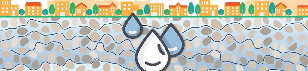
It might not be Robin Leach’s Lifestyles of the Rich and Famous but for me it’s home. Entering my home might not be obvious. For you, a knock on a door or a turn of a key, and you’re in. For me it’s a bit trickier. It starts with me as a raindrop. After parachuting in from the clouds I soak into the ground to recharge my home, the aquifer.
Groundwater’s word of the day:Recharge, also called infiltration, is when water is added back into the aquifer. This can happen through precipitation such as rain fall or when snow melts or from water seeping into the aquifer from surface water such as a pond or stream.
So what is an aquifer? First, to find an aquifer you have to look down. Believe it or not, where you are standing right now, there could be an aquifer underneath you. It might take some work digging down to get to it, but it’s there.
Believe it or not, where you are standing right now, there could be an aquifer beneath you.
When you dig into the ground, what do you find? Dirt, sand, rocks. Theses are all materials that can be found in an aquifer. What materials are in the aquifer depend on the geology of the land and how it was formed a long, long time ago. Glaciers played an important role carving out the land. The materials left behind when the glaciers retreated or melted helped form the aquifers, including the Waterloo Moraine where recharge for some of the aquifers begins in Waterloo Region.
The Waterloo Moraine consists of thick deposits of sand and gravel, separated by clay layers, where large quantities of recharge help supply the water to the Region’s water supply wells. The map shows the Regional recharge areas of the Waterloo Moraine where sand is exposed at the surface allowing the recharge into the aquifers.
But make not mistake, recharge happens everywhere beneath your feet, not just the green areas.
Map of Waterloo Region showing recharge areas of the Waterloo Moraine in green
Aquifers in much of Waterloo Region consist of sand and gravel with layers of clay. The exception is most of Cambridge where the aquifers are in bedrock.
Getting back to me parachuting from the clouds and soaking into the ground…once I have soaked into the ground, I look for spaces between the different materials – sand, gravel or bedrock. Those spaces might look tiny to you but for me, they’re plenty big.
Hands-on activity: Place some pebbles or marbles in a glass. They represent the sand or gravel in an aquifer. Look closely at the pebbles/marbles. Do you see spaces? Now pour water into the glass. This represents the recharging or adding water back into the aquifer. Where does the water go? Does it sit on top of the pebbles/marbles or does it fill up the spaces?
Groundwater Foundation instructional video on how to make an aquifer in a cup
That’s what an aquifer is, an area underground filled with groundwater – me – in the spaces between the sand grains, rock or gravel.
Illustration of an aquifer
And once I’m there I don’t sit still. Water doesn’t like to stay in one place for too long. So while I’m underground, I’m slowly moving a few metres per year through the spaces between the sand, rock or gravel. Eventually I’ll make my way into a stream and evaporate as part of the water cycle before parachuting down from the clouds to recharge an aquifer once again.
So there you have it. Hopefully you now have a better idea of where I live. And if you are looking for something to do that involves ice cream, check out this edible aquifers recipe. It’s a fun and tasty way to learn more about my home.
Cheers, Groundwater
Groundwater is your drinking water. But where can you find groundwater? No. R.S.V.P. required. Your exclusive tour of groundwater’s home. #iamgroundwaterblog
Groundwater here. Unlike my friends in lakes and streams, I don’t always get the attention I deserve. Now that I have my own blog, I’d like to share some interesting facts about me.
Illustration of aquifer where you find groundwater
I live underground. I am the rain and the melted snow that soaks into the ground. You live in a home above ground – I live in an aquifer underground. An aquifer is the layers of sand grains, rocks and gravel found underground. When I soak into the ground, I fill up the spaces between the sand grains, rocks and gravel. It’s like a big apartment building for water droplets, except it’s underground.
I am always moving. I might not move as fast as my cousins above ground in streams and rivers but I am always moving. Moving underground between the sand grains, rocks and gravel is hard work. Think of it like going through a maze in the dark. How long I stay underground is hard to say, could be days or years. But at some point I rejoin my cousins above ground in a stream, river or lake and go through the water cycle once again.
You have a doctor, I have a hydrogeologist.Hydrogeologists study me and keep me healthy. To do this, they use the geology of the land to understand how I move underground. Knowing how groundwater interacts with the materials underground helps the hydrogeologist figure out the path I take underground and how long that journey might take.
Sand cleans me. When you are dirty you probably take a shower or a bath. And if you live in Waterloo Region I most likely dropped by for a visit. Sand is my shower. When I am travelling underground, I move through sand grains that help clean me.
There you go – four cool facts about me. I’d love to hear from you. Share your cool facts about groundwater. And if you learned something new today that you found interesting I’d love to hear about that as well.
Unlike groundwater’s friends in lakes and streams, groundwater doesn’t always get the attention deserved. 4 cool facts you might not know about groundwater. #iamgroundwaterblog
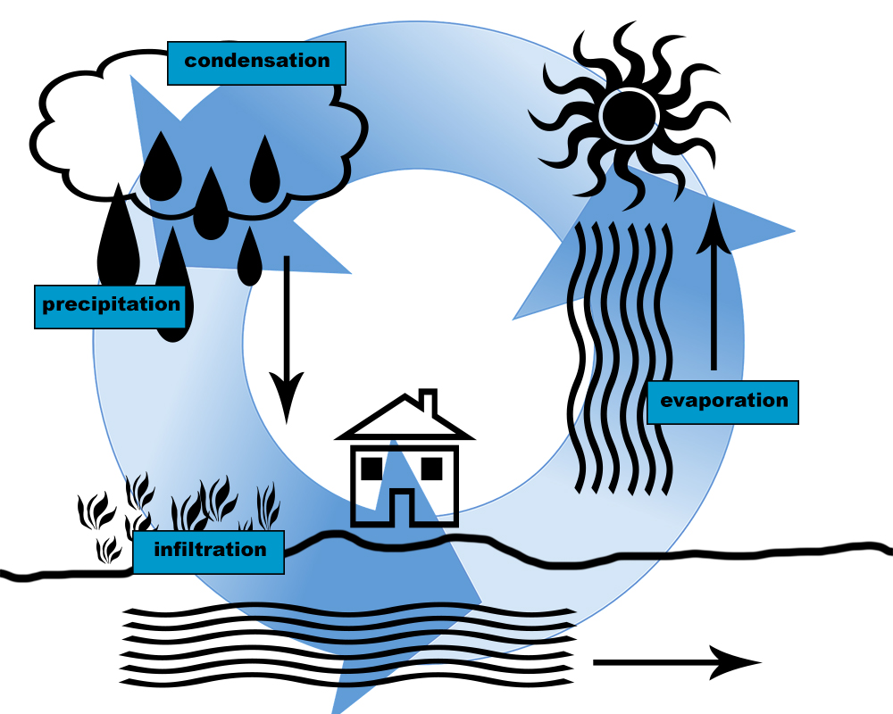
Our planet earth has always had the same amount of water. The water we use today was also there for the dinosaurs to drink. And through the water cycle, water can be found everywhere. It is always moving and changing states as a liquid, solid or gas.
Illustration of the water cycle
Water can be found in streams, rivers and lakes. It’s in the air and underground. It is the glaciers, rain and snow. And it’s in our food, plants and bodies.
Earth, also known as the blue planet, has a lot of water – about 71 per cent of our planet is covered in water. But how much of it is drinkable fresh water? First look at the oceans – that’s a lot of water. In fact 97 per cent of all water is salt water – water we can’t drink without desalinating or removing the salt. That leaves three per cent remaining as fresh water. About two per cent of all fresh water on our planet can be found underground as groundwater. Water is always travelling, even if it has to take the slow route, underground through rocks and dirt.
Video: NASA | Earth Science Week: Water, Water Everywhere!
Locally Waterloo Region is part of the Grand River watershed managed by the Grand River Conservation Authority. But what is a watershed? Is it a shed made out of water? Nope. A watershed is an area of land that drains into the same body of water. Think of it like a tree branch. In Waterloo Region groundwater seeps into small waterways such as Schneider’s Creek, Laurel Creek and Mill Creek that drain into the larger Grand River. The Grand River and many other watersheds drain into Lake Erie and eventually into the Atlantic Ocean.
Video: What is a watershed
Have you ever watched the National Film Board movie “Paddle to the Sea”? The movie reminds me of a watershed. It is about a child who carves out a man in a canoe and sets it on a frozen stream waiting for the spring thaw. The movie follows the canoe as it travels from the stream to larger waterways and finally to the ocean.
The water cycle and the fact we all live in a watershed are reminders we all share the same water and we all live downstream from someone else. And why we all have a role to play when it comes to protecting water.
What do you think are the biggest issues for water? What steps should our community take to protect water? Do you have tips to share that can help others be water protectors?
Water connects us. Waterloo Region is in the Grand River watershed. All water in the watershed drains into Lake Erie and eventually into the Atlantic Ocean. We all live downstream and we all need to protect water. #iamgroundwaterblog
Hi, I’m groundwater. You might not realize it but you and me – we spend a lot of time together. You drink me, cook and wash with me and so much more.
When you turn on the tap do you ever wonder how I get there? It’s a bit of a journey for me. I get a lot of help along the way to make sure I’m clean and safe for you to drink.
Join me on my adventures! Learn about me – your drinking water. Find out where I live, how I get to your tap and what you can do to help keep me healthy. You can also find more on the Region of Waterloo website.
I want to hear from you. Share your ideas or ask me a question and I’ll do my best to answer it.
Cheers, Groundwater.
You might not realize it but you and groundwater spend a lot of time together. Groundwater is the water you drink, cook and wash with and so much more. Check out the I Am Groundwater blog to learn more. #iamgroundwaterblog